


Society
Environment
Politics
Economy
Culture
Basque language
Feminism
Education
International
Opinion
friday 30 may 2025
Automatically translated from Basque, translation may contain errors. More information here. 
Translated by Udalatx. The Milestone of Besaid
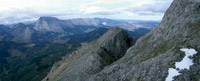
- The journey that we have been completing along the Gipuzkoa–Bizkaia border is coming to an end; the first stage left Debate and ended in Eibar, then visiting the most emblematic mountains of Elgeta to draw a unique circular route. The third and final session begins and ends at the Campanario’s neck, near the magical summit of Elgeta and Intxorta. In addition, the journey will be finished as it deserves; the abrupt summit of Udalatx (Udalaitz), climbing the three-faced border of Besaide. In fact, Udalatx itself is considered by many to be the natural milestone for the separation of Álava, Gipuzkoa and Bizkaia. The Great Ascension Begins...

Gorka Azkarate
This time we won’t have to walk many kilometers, just a little over a dozen. Taking into account that in the first stage we have walked twenty-five and in the second we have walked more than seventeen. However, it is proposed to climb a steep mountain different from the whole journey in this third and final excursion, the Udalatx, the first – or last – of the rocks of Durango. We have climbed Arno, Kalamua, Azketa, Urko, Egoarbitza, Erdella and Intxorta, among others, in previous days, but all these boxes can not, as any face of Udalatxe does, challenge the mountaineer. It is well known that the mountains of Durango are generally very steep and not easy to reach. All you have to do is go to Anvotar, Alluitz, Navarre or Mugarra to check this out. The Udalatx, like the whole mountain range, is also extremely rugged.
We will start the excursion in Campanario; during the holidays, especially during the summer, a large number of people usually come to the tables and grills at the neck of the Campanario to make the law of food in the beech forest of the place. If you don’t want to eat outside, you can also try the dishes of the hostel located on the side of the road. The GI-632 / BI-632 road between Gipuzkoa and Bizkaia (Arrasate and Elorrio) runs over Kanpazar, and the abundant industrial activity in these valleys has made this neck an important transit point for cars and trucks in recent decades.
We will find the red white paint symbols of the Gipuzkoa Tour and we will complete the Besaidera painting by following them. The path is wide and without hard climbs; quiet, ideal for slowly warming up the muscles. Often, yes, it is muddy. In this part of the initiation we can enjoy a unique panoramic view of the Elorrio Valley, as well as a view of the vertical walls of the Udalatxas that descend to this slope.
As we continue along the way, we arrive at a crossroads; the painting symbols turn to the left, but we select the path to the right and we quickly reach the hill of Saint Lucia, where we intend to visit the hermitage of the same name. The hermitage of Santa Lucia is located on a strategic hill, almost completely engulfed by a beautiful oak tree. The hermitage has a kind of shelter on its wing, offering the possibility of storing it in case of accidental catches of bad weather. With the permission of Artadi Cerrado, we find a slot and turn our gaze towards the Udalatx stone piece. We will then return to the crossroads to join the Beside Road again and continue on.
Besaide’s neck is already near; we are circling Udalatx following the GR-121 route and it is not long before we reach the point that defines the border with Álava, Bizkaia and Gipuzkoa. Previously, we will start from the Arrasate Town Hall neighborhood and we will find the road that comes through Udalatx, next to a fountain. After visiting the monument of Besaid very close to here, we return to this point to face the slopes of Udalache again. It is important to know that there is a path that can take us to the City Hall neighborhood, or we will have to change the plans previously made. We climb a last slope and reach the monolith built in 1955 in memory of the mountaineers who died on the mountain: We are located on the hill of Besaide.
Above Besaide, we will enjoy a unique view of the Duranguesado Mountains: Orisol, Izpizte, Tellamendi, Anvotar, Alluitz, Aitz-txiki, Nacillaitz, Mugarra... On the other side is the Murugain that dominates Arrasate and, behind it, Aloña, the summit of Aizkorri, Orkatzategi, Amuategi, Mugarriluze, Elgeamendi, Kurutzeberri... And, how not to climb the Murugain overhang of Mondragón? We will visit both monuments of Besaide, rest and return to the place where the hardest climb of the day begins.
We clenched our teeth and started the climb of the Udalatx with a quiet step; we have a five-hundred-metre climb ahead of us and it is important to find the right rhythm in the meters of the beginning. The trail will enter the forest, zigzagging, and we will ascend following piles of stones or cairns, subtracting meters from the mountain at each step. We leave the forest and arrive at the neck of the Pozutxes, marked by a remarkable pile of stones. Getting to the Pozutxes Pass will be especially important if we want to get off this slope. From now on, we will advance in the wildest and most rugged area of Udalache.
The most experienced mountaineers can try to make the entire summit of Udalatxe by climbing the peaks of Gaintxorta and Erdikoatxa before reaching the main summit of Udalatxe. The route proposed here, makes the journey, avoids the most dangerous areas of the summit and completes a safer ascent. The trail will climb, in any case, without rest, and it will be difficult for us to win the meters. As we ascend, the stones will multiply along the way, and we will have to take every step carefully. With a glimpse of the cave of Udalache, we will do it directly to it. This cave is located in the entrails of the main peak of Udalache, and in a few minutes we will climb from the cave to the top. However, a stop at the cave is really worth it; if everything is to be said, this hole is more protective than the cave, which does not have much depth. In any case, it is a good refuge if the weather is bad. One last effort and we will reach the top of Udalatxe. The view is breathtaking in all directions and we will easily discover the multitude of mountains of Álava, Bizkaia and Gipuzkoa. You can spend hours looking at the orientation table at the top, weather permitting, looking in all directions.
Before descending on the slope that faces the neck of the Campanario, we turn to the cross that is a little lower than the main peak. This cross is a unique watchtower that dominates the Deba period. It's downstairs, of course. A few meters down, we leave the road that goes down to the Town Hall neighborhood and join the path that makes it to the left –yellow paint symbols–, in order to go down to Campanario. The violent slope may cause some fear, so it is advisable to take it easy and be careful. Soft stone and mud are often mixed on this slope, and although there is not much risk, there have been opportunities for laprast and a fall. At least we won’t get lost because the road is clear. Slowly we will lose the meters, avoiding the quarry near the port of Campanario, until we reach the neck. We will notice that we are doing the last meters of the tour, a sign that the beautiful journey is coming to an end. Fortunately, there are still many of our mountains that we do not know; as soon as we reach the Campanario and start to release the boots, with our imagination, we will begin to prepare the next crossing.
We will start the excursion in Campanario; during the holidays, especially during the summer, a large number of people usually come to the tables and grills at the neck of the Campanario to make the law of food in the beech forest of the place. If you don’t want to eat outside, you can also try the dishes of the hostel located on the side of the road. The GI-632 / BI-632 road between Gipuzkoa and Bizkaia (Arrasate and Elorrio) runs over Kanpazar, and the abundant industrial activity in these valleys has made this neck an important transit point for cars and trucks in recent decades.
We will find the red white paint symbols of the Gipuzkoa Tour and we will complete the Besaidera painting by following them. The path is wide and without hard climbs; quiet, ideal for slowly warming up the muscles. Often, yes, it is muddy. In this part of the initiation we can enjoy a unique panoramic view of the Elorrio Valley, as well as a view of the vertical walls of the Udalatxas that descend to this slope.
As we continue along the way, we arrive at a crossroads; the painting symbols turn to the left, but we select the path to the right and we quickly reach the hill of Saint Lucia, where we intend to visit the hermitage of the same name. The hermitage of Santa Lucia is located on a strategic hill, almost completely engulfed by a beautiful oak tree. The hermitage has a kind of shelter on its wing, offering the possibility of storing it in case of accidental catches of bad weather. With the permission of Artadi Cerrado, we find a slot and turn our gaze towards the Udalatx stone piece. We will then return to the crossroads to join the Beside Road again and continue on.
Neck of the Besaide
Besaide’s neck is already near; we are circling Udalatx following the GR-121 route and it is not long before we reach the point that defines the border with Álava, Bizkaia and Gipuzkoa. Previously, we will start from the Arrasate Town Hall neighborhood and we will find the road that comes through Udalatx, next to a fountain. After visiting the monument of Besaid very close to here, we return to this point to face the slopes of Udalache again. It is important to know that there is a path that can take us to the City Hall neighborhood, or we will have to change the plans previously made. We climb a last slope and reach the monolith built in 1955 in memory of the mountaineers who died on the mountain: We are located on the hill of Besaide.
Above Besaide, we will enjoy a unique view of the Duranguesado Mountains: Orisol, Izpizte, Tellamendi, Anvotar, Alluitz, Aitz-txiki, Nacillaitz, Mugarra... On the other side is the Murugain that dominates Arrasate and, behind it, Aloña, the summit of Aizkorri, Orkatzategi, Amuategi, Mugarriluze, Elgeamendi, Kurutzeberri... And, how not to climb the Murugain overhang of Mondragón? We will visit both monuments of Besaide, rest and return to the place where the hardest climb of the day begins.
Location of Udalatx
We clenched our teeth and started the climb of the Udalatx with a quiet step; we have a five-hundred-metre climb ahead of us and it is important to find the right rhythm in the meters of the beginning. The trail will enter the forest, zigzagging, and we will ascend following piles of stones or cairns, subtracting meters from the mountain at each step. We leave the forest and arrive at the neck of the Pozutxes, marked by a remarkable pile of stones. Getting to the Pozutxes Pass will be especially important if we want to get off this slope. From now on, we will advance in the wildest and most rugged area of Udalache.
The most experienced mountaineers can try to make the entire summit of Udalatxe by climbing the peaks of Gaintxorta and Erdikoatxa before reaching the main summit of Udalatxe. The route proposed here, makes the journey, avoids the most dangerous areas of the summit and completes a safer ascent. The trail will climb, in any case, without rest, and it will be difficult for us to win the meters. As we ascend, the stones will multiply along the way, and we will have to take every step carefully. With a glimpse of the cave of Udalache, we will do it directly to it. This cave is located in the entrails of the main peak of Udalache, and in a few minutes we will climb from the cave to the top. However, a stop at the cave is really worth it; if everything is to be said, this hole is more protective than the cave, which does not have much depth. In any case, it is a good refuge if the weather is bad. One last effort and we will reach the top of Udalatxe. The view is breathtaking in all directions and we will easily discover the multitude of mountains of Álava, Bizkaia and Gipuzkoa. You can spend hours looking at the orientation table at the top, weather permitting, looking in all directions.
Descent to the Campanario
Before descending on the slope that faces the neck of the Campanario, we turn to the cross that is a little lower than the main peak. This cross is a unique watchtower that dominates the Deba period. It's downstairs, of course. A few meters down, we leave the road that goes down to the Town Hall neighborhood and join the path that makes it to the left –yellow paint symbols–, in order to go down to Campanario. The violent slope may cause some fear, so it is advisable to take it easy and be careful. Soft stone and mud are often mixed on this slope, and although there is not much risk, there have been opportunities for laprast and a fall. At least we won’t get lost because the road is clear. Slowly we will lose the meters, avoiding the quarry near the port of Campanario, until we reach the neck. We will notice that we are doing the last meters of the tour, a sign that the beautiful journey is coming to an end. Fortunately, there are still many of our mountains that we do not know; as soon as we reach the Campanario and start to release the boots, with our imagination, we will begin to prepare the next crossing.


Most read
Using Matomo
#1
#5
Maria Ortega Zubiate

Newest

Artificial Intelligence (AI)
For €264 million, Musken Grok will be installed in IA Telegram users
In a year, Grok will have the opportunity to walk on Telegram, enter 1 billion users of the messaging company and receive $264 million for it. Pável Dúrov, founder and owner of Telegram, has endorsed the operation on its official channel.
2025-05-30
Xabier Letona Biteri
UN reminds Spain that despite signs of torture, it has not investigated the case of Raúl Fuentes
When he was arrested in 1991, Raúl Fuentes denounced that he had been tortured by the Spanish police at the Bilbao Police Station. The complaint was ignored by the Spanish courts because, among other things, the crime was subject to a statute of limitations. Spain has now been... [+]
2025-05-30
Sustatu
The jewel that Euskaraldia brings us from the town of Artazu
The short film "Belarrivals and Ahopresta", shot this spring in the town of Artazu by filmmaker Oskar Alegria under the pretext of the 2025 Euskaraldia, which closed last Sunday, has been put on the web. A rereading of the concepts of ears and mouth and much more, an emotional... [+]
2025-05-30
Maria Ortega Zubiate
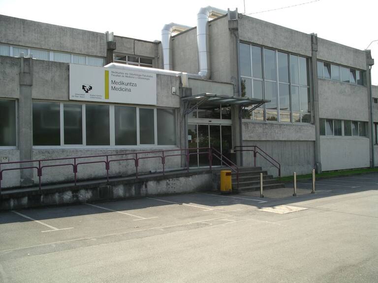
The government is “concerned” about a 60% reduction in the number of new places in Basque in the Faculty of Medicine of the University of the Basque Country
On the other hand, the UPV/EHU explains that it is impossible to offer the 40 new places promised, since they do not have the resources to do so. The UPV/EHU has shown its intention to gradually increase the number of new places.
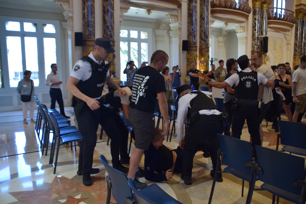
Local police arrested a young man in protest at the plenary session for the San Sebastián Guard
There were moments of tension on Thursday at noon in the municipal assembly hall of the City Council of San Sebastián.
2025-05-30
Maria Ortega Zubiate
Hamas “analyzes” the ceasefire agreement proposed by the United States
Hamas denounces that the proposal will ensure that “killings and famine” continue, but adds that it is considering what response. The United States reports that Israel has accepted the proposal.
2025-05-30
ARGIA
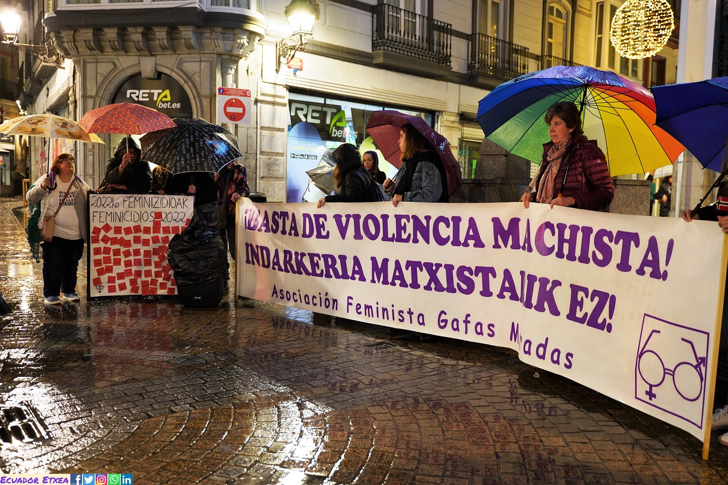
A man kills his 13-year-old daughter and then commits suicide in Bilbao
It happened at the family home in Bilbao, in the Larraskitu district. After a violent argument, the woman fled the house and called the local police. Police found the bodies of her father and daughter in the house. The woman was taken to hospital because of her injuries.
2025-05-30
Olaia L. Garaialde
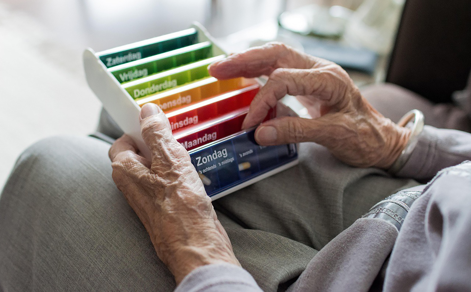
COFNA believes that local pharmacies can be a tool against depopulation
The Official College of Pharmacists of Navarre (COFNA) and the Department of Territorial Cohesion of the Government of Navarre have launched a program for the correct intake of medication by rural people.
2025-05-30
Gorka Peñagarikano Goikoetxea
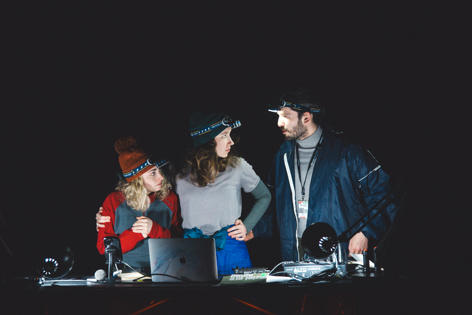
Manifesto to escape from the bunker
The death is called Eduardo
- By the author: Formol Company (and Ander Lipus Manifesto)
- In which: Model Room, Zarautz, Festival of Literature
- When shall we: The 23rd of May.
-------------------------------------------------------------
The play takes place in a bunker... [+]
2025-05-30
ARGIA
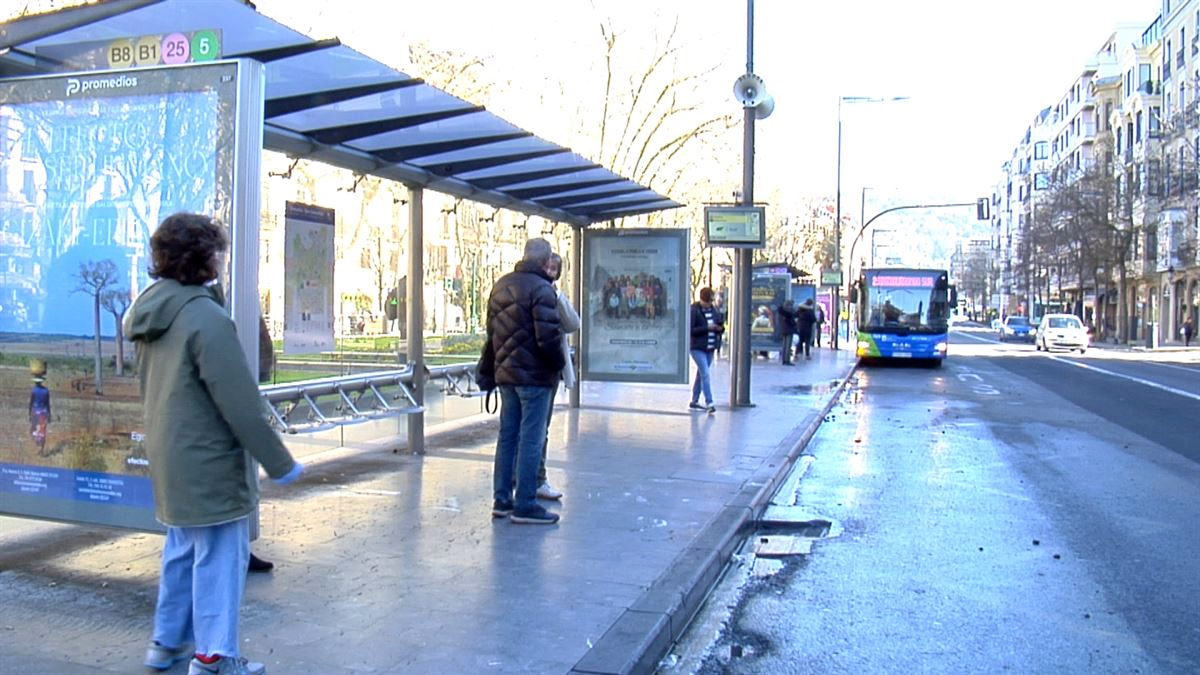
The Spanish Government wants to establish more smoke-free areas: marquesinas, campuses, terraces...
The Spanish Ministry of Health is preparing a draft law that would establish new smoke-free zones and would have an impact on the four territories of the Southern Basque Country. These new areas include bar terraces, university campuses or bus marquees. It would also affect... [+]
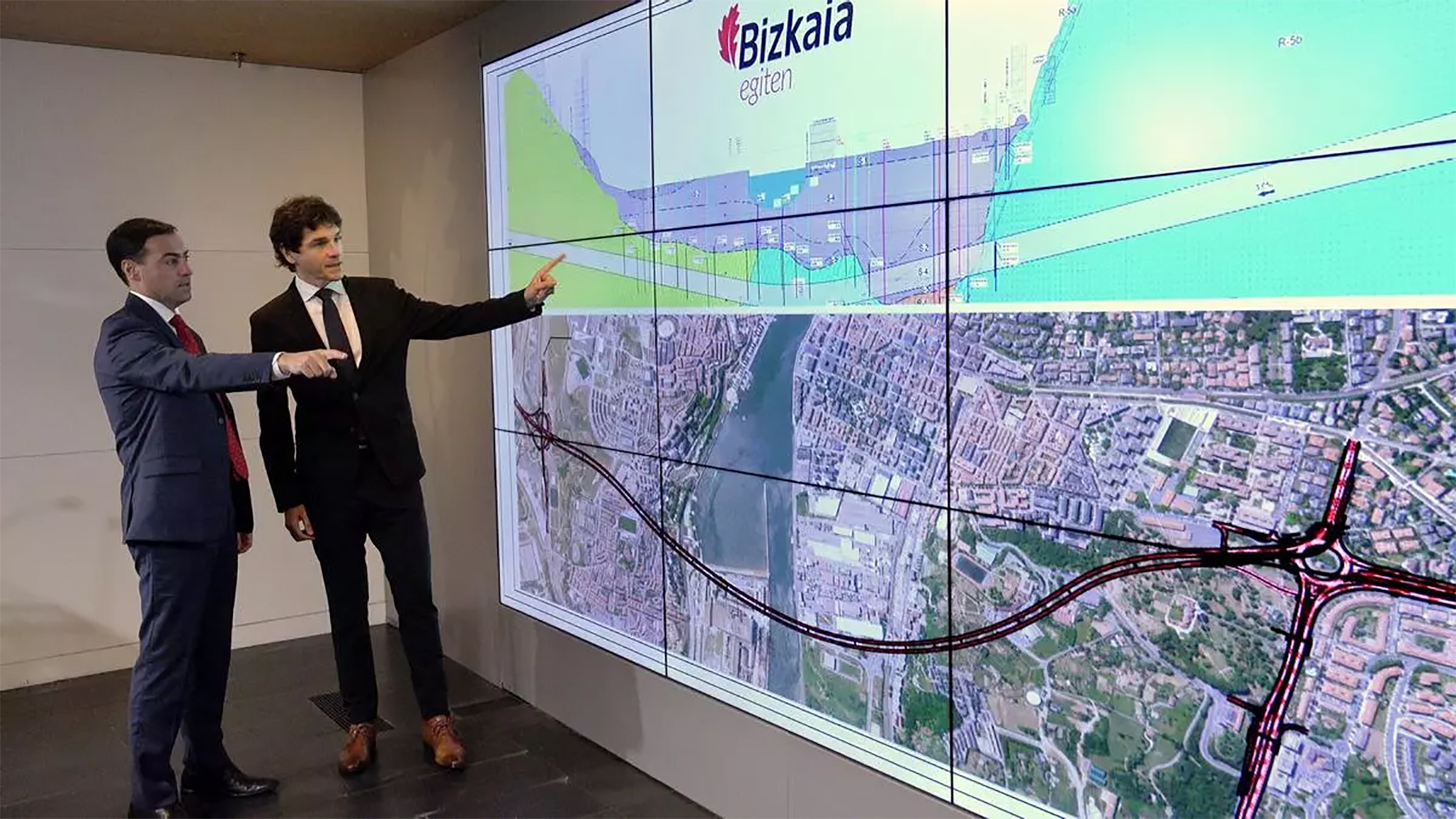
The Provincial Council of Bizkaia entrusts the Government with the possibility of connecting the subway under the Bilbao estuary
Together with the tunnel project for vehicles to connect the two banks of the Bilbao estuary, the Provincial Council of Bizkaia also announced in 2022 a shuttle train that would connect Areeta with Sestao. The Deputy for Infrastructure and Territorial Development, Carlos Alzaga,... [+]
2025-05-30
Urko Apaolaza Avila
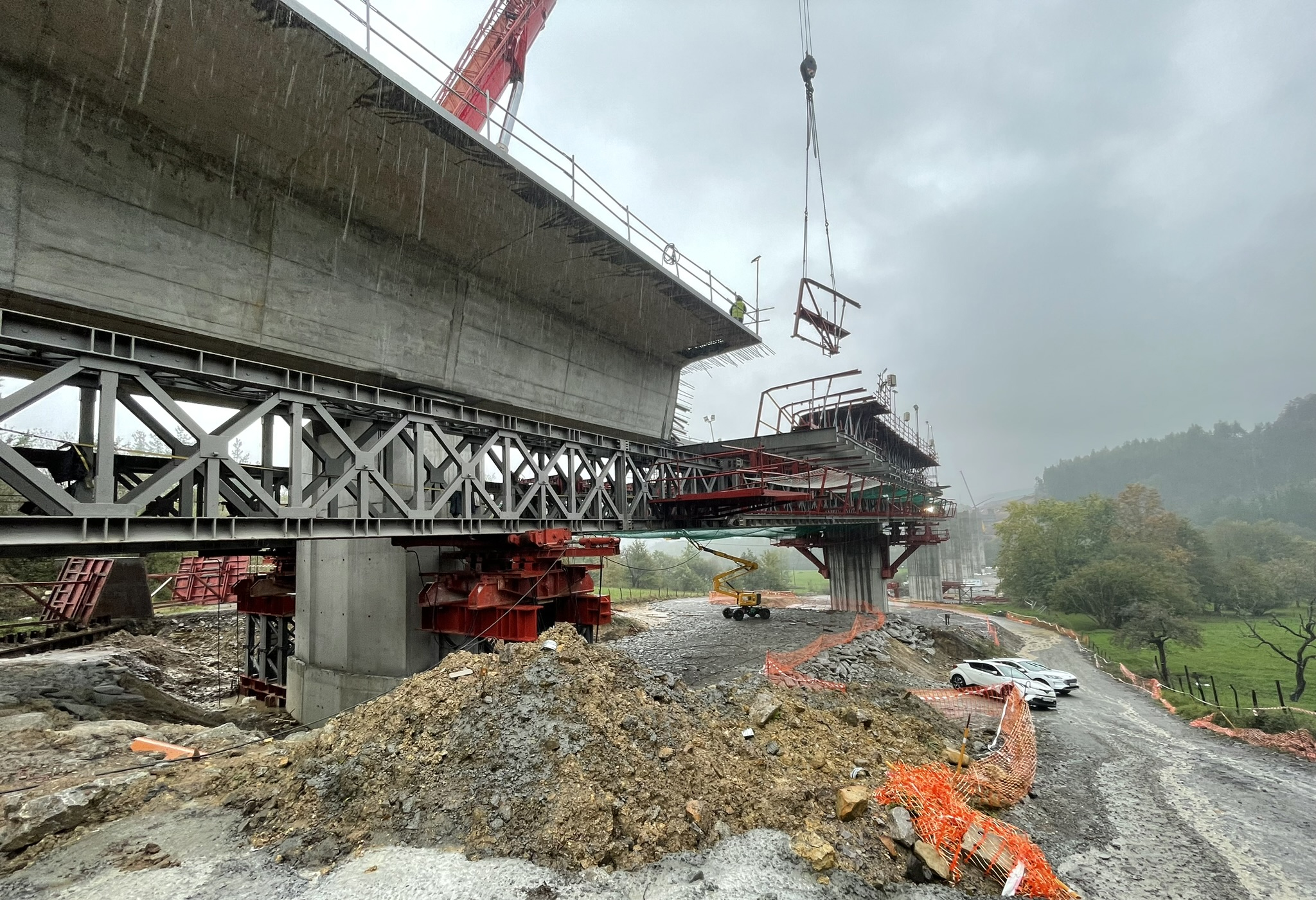
AHT denounces that the worker killed in Atxondo has been a victim of "greed" by AHT Stop!
AAV Stop says that behind deaths like Tuesday in AAV’s works are only “conditions of slavery” and “racist, humiliating and degrading treatment.” The City Council of Atxondo has requested that the facts be investigated and clarified. Thirteen workers have already died... [+]
2025-05-29
ARGIA
Segregation education
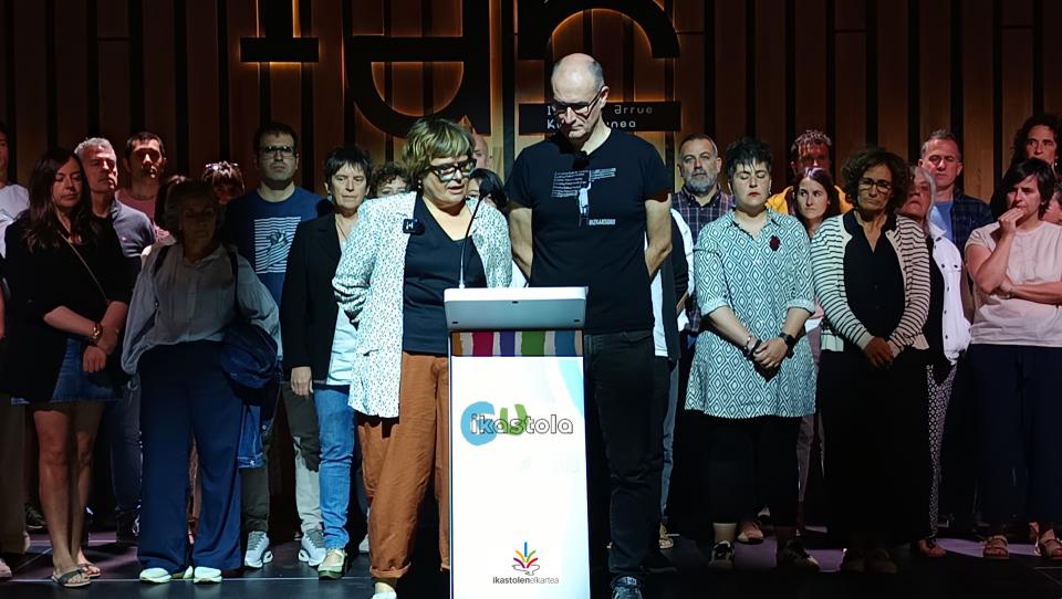
Association of Schools: “The management of registration does not serve to end segregation”
In May 2023, the Basque Government issued a decree on the good integration of vulnerable children in the Basque education system, and today Ikastolen makes a very critical assessment of it: it has not served to end segregation. A number of proposals have also been made to... [+]

2025-05-29
Unai Lomana Uribezubia
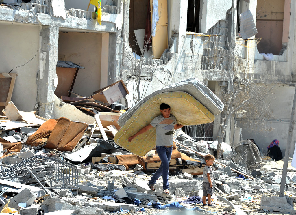
CAF denounces the start of the second phase of the railway under construction in Palestine
The National and Civil Action Committee of the occupied Jerusalem has reported the beginning of the second phase of the train and has condemned it for its purpose of strengthening communication between settlements. Israel has announced the establishment of 22 new settlements in... [+]
Eguneraketa berriak daude