


Plains under the feet, returned to the dolmens
- About eighty-five dolmens are known in Álava; near Agurain, in the warmth of the Llanada de Álava, there are two of the most popular: The Witch's House and the Adulteress. If the mere visit of these dolmens was not a sufficient excuse to approach this beautiful corner of the Basque Country, we propose to complete a mountain excursion as simple as beautiful, breaking the plain through the Sierra de Encia, which rises more than a thousand meters high. A great pleasure in the unequaled area.

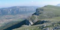
We will start the excursion starting from the center of Agurain and going to the exit of the town following Calle Foru. Until we cross the bridge that crosses the main highway and take the regional road that goes to Opakura and the port, we will have to make the first steps of the trek between cars, in a fluctuating area of asphalt not prepared specifically for pedestrians. The village of Okariz, however, is the first milestone of our route, to which we will go, following the path that would lead us to Opakura and then going to the left or, better, as soon as we cross the motorway, taking a calmer agricultural road parallel to the road of Opakura. After a couple of kilometers that will help us to warm our legs, we arrive to the town of Okariz, in Donemiliaga. The Vicuña, located in the same municipality, will be our next destination. In these uneventful kilometers of the estreina, the lonely traveler will find true peace and inner rest. A space for reflection, basically. A narrow agricultural path connects Okariz and Bikuña, and we will arrive at the latter shortly. The Sierras de Encia can now be seen nearby. It’s time to brush your teeth and climb up the plain to the mountains.
The Legaire Clearing House
Following the broad path that leads from the village ofBikuña to the Bikuña’s neck is probably the most direct and used route to climb to the summit of Encia. This time, however, we propose to follow an unknown but unbeatable path: Follow the unique path that rises directly to the port of Atau between the peaks of Mirutegi and Surbe (Atau). Reaching the Legaire Clearing Point from the Atau Reception will undoubtedly be one of the most wonderful moments we will experience during the walk. The transition from the germ of the enclosed forest under the reception to the luminosity of the vast Legaire countryside is very filling.
We arrive at Harrat and turn first to the left to climb to the summit of Surbe or Atau (1158 meters) with a unique view towards Navarre. In front of us will be the giant Beriain, the watchman of the infinite edge of the mountains of Encia and Urbasa. On the other side of the plain, we will notice nearby the famous peaks of Aratz and its surroundings (Allaitz, Allarte, Umandia, Arbarrain...) and behind the Aizkorri mountain range. Further to the east, the southern peaks of Aralar, also well known as Putterri and Artxueta. With good weather, the mountain ranges of Kodes and Cantabria will close the wide view over the south of the Araba that we will have from Surb.
After enjoying the view and resting, we will head towards the hill where the Mirutegi Cross is located, crossing the Legaire clearing; we will pass for the second time around the Atau reception area and face the last slope of the Mirutegi. If we have enjoyed the magnificent view over the Plains of Álava from the summit of Surbe, what we will have from the watchtower of Mirutegi will not seem too low. We’ll see Agurai a little far away, since we’ve already been around 12 kilometers since we started the route. Mirutegi (1185 meters) is the famous cross of Encia, but the Ballo (1197 meters) near this summit is the highest point of Encia. Leaving the clearing of Legaire, entering the beautiful beech forest and looking for the remains of the path that will lead us to the neck of Bikuña –carefully follow the remains of cairn or piles of stones–, we will start the route to the port of Opakua. As we approach the road of the Port of Opakura from a forest track, we will notice more and more the summit of the Arrigorrsta that will give continuity to the Sierra de Encia.
Arrigorrista and Santa Elena
Cross the road in the port of Opakura and soon the path will show an upward trend, the target of the special Arrigorrsta. After a beautiful climb of about a quarter of an hour, we arrive at the well-known summit of the Sierra de Encia. The Arrigorrista (1153 meters) offers us a somewhat limited view, since the forest and vegetation almost completely hide the highest point. Half bad, if there's a window that allows a view over the plain. In front we will see the village of Arrizala and near it the dolmen of the Sorginetxea. Let’s continue, however, the excursion that takes us through the summit of Encia!
If the climb to Arrigorrista has been a bit confusing at certain times, in the subsequent kilometers without many incidents we will be accompanied by a comfortable and pronounced path that we will advance quickly. We will climb to the summit of Atxuri or Larredez almost without warning (1103 meters), as if it were just another hill placed by the route. As the path has left the forest with the departure of the Arribirista, we have regained a great panoramic view over the plain. In this area, moreover, the path sometimes advances along the very edge of the abyss, making the route even more spectacular. Tasting every step taken, we arrive at the San Juan’s neck. On this neck we find the escape route that leads directly down to the plain, which is without delay the path that leads to the village of Egileor. However, to round off the circular route, we will follow the summit in search of St. Helena.
Playing with the trail that appears and disappears, but attentive to the remains of the cairn, we will advance, therefore, to the summit of Santa Elena (1111 meters). Since the highest point of this mountain is in the forest, we will have to take advantage of the watchtower a few meters below to make a final look at the plain. In fact, with the descent of Luzkando’s neck, located at the foot of Santa Elena, we will leave the summit and take the path towards the road that unites the towns of Gereñu and Alaiza, leaving Idiagaina, Itxogaina and the rest of the peaks that surround Vitoria (Capilldui, Pagogan, Lendiz,...) for the next one.
Return to the Old Man
The descent from the neck of Luzkando to the plain is also really beautiful, which will give the tour a perfect ending. Plunging our legs between the leaves, we pass a forest of dreams and, surrounded by a pond, we reach the road that separates Gereñu from Agurain. Following the road we will only have to reach the Old Town to complete an unbeatable walk. We arrive at Agurain with the sweet feeling of having spent a wonderful day. We don’t need much to achieve full happiness.


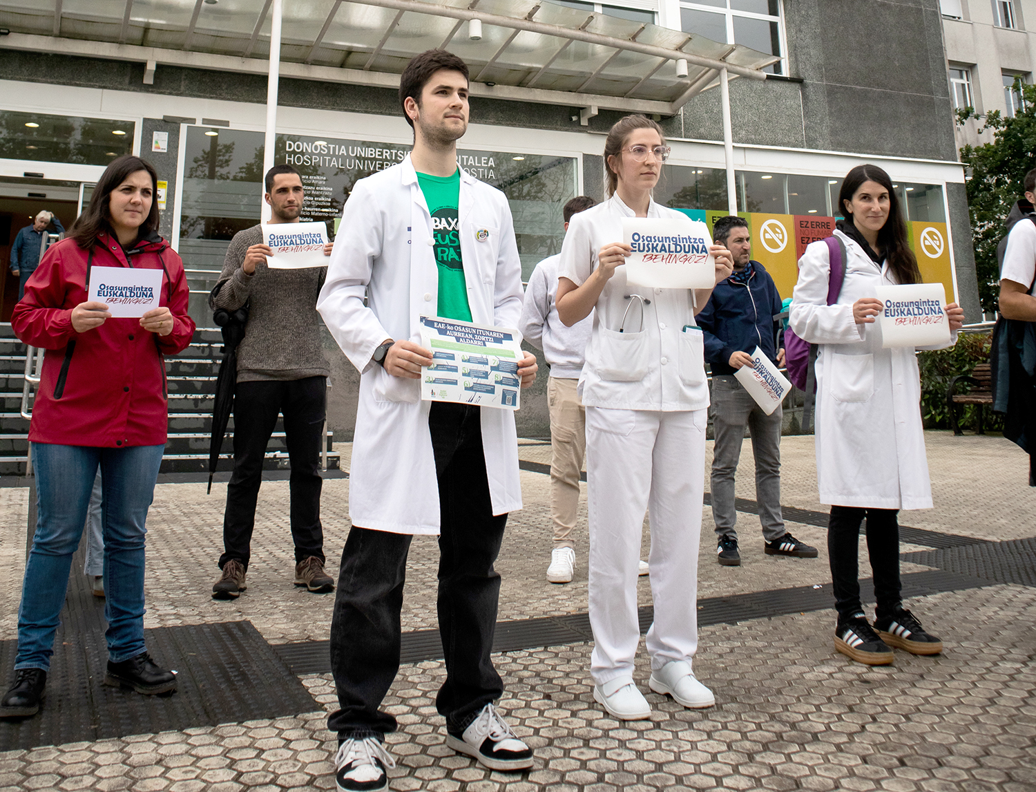
Osasungintzako 501 langilek bat egin dute zortzi eskaera zehatz dituen manifestuarekin. Helburua, osasun arreta euskaraz eskaini, eman eta bermatzea, “edonon eta edonoiz, maila guztietan eta ahoz zein idatzizko harremanetan”.
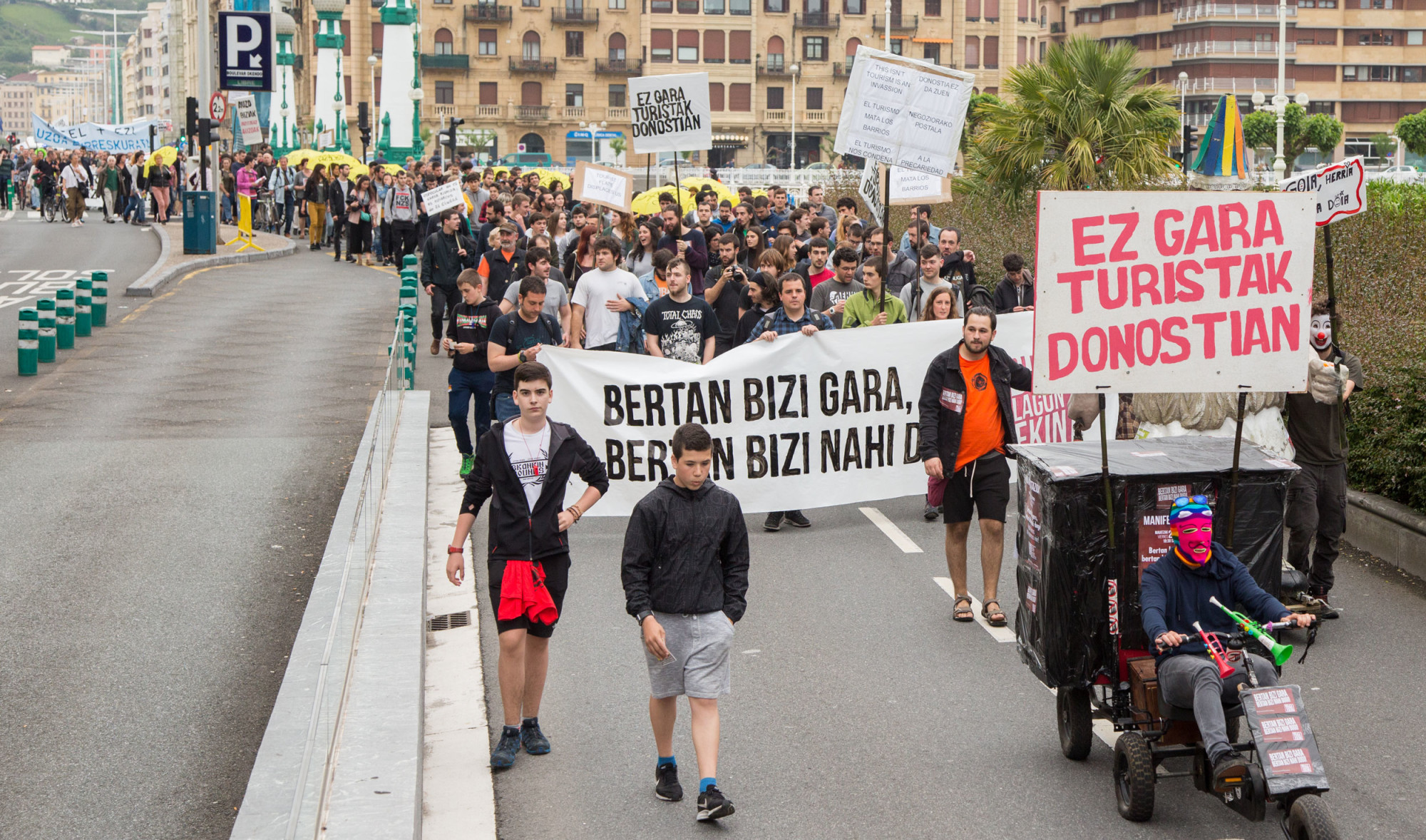
BiziLagunEkin desazkunde turistikoaren aldeko Donostiako plataformak ekainaren 15erako deitu du manifestazioa, Europa Hegoaldeko beste hainbat hiritako eragileek bezala. Turistifikazioa salatu eta hiri eredu alternatiboa aldarrikatuko dute.
Metro Bilbaok I-SEC Aviation Security S.L. segurtasun-enpresa kontratatu zuen apirilean. Horren aurrean, kexak aurkeztu dituzte dozenaka herritarrek Metro Bilbaoren bulegoetan, Bilbo-Palestina Herri Ekimena eta Nodo BDZ-Bizkaiak deituta.

Urtebete eta erdiz sarraski genozidak gauzatu ondoren, Erresuma Batuko zenbait hedabidetako kontseilu editorialek hitza hartu dute, bat-batean, Israel Gazan egiten den sarraskiaren aurka. Establishmenteko gizatxar mediatikoek aldaketa usaina hartu diote haizeari.

Joan den astelehenean bilera egin zuten Kordako kudeatzaileek 21 Zabalgunea sozietate publikoko ordezkariekin, baina ez zuten inongo akordiorik lortu. Husteko agindua, hortaz, indarrean da. Ertzaintza bertaratu egin da gauerdian, eta espazioaren barruan itxi dira hamar lagun... [+]
.jpg)
Gazako Osasun Ministerioaren arabera, AEBek eta Israelek kontrolatzen dituzten laguntza humanitario banatzeko zentroetan 102 palestinar hil dituzte azken zortzi egunetan: "Gerra krimen beldurgarria da, nahita egindakoa eta behin eta berriz errepikatutakoa". Erasoa... [+]
Faltan Botatzen Dugu plataformak eman du gertakariaren berri, eta zaintza aringarrien zerbitzuaren "egoera kritikoa" salatu du. Medikuak haren kontakizuna argitaratu du sare sozialetan, eta jakinarazi du lana utzi duela denbora batez: "Ezinezkoa zait baldintza... [+]
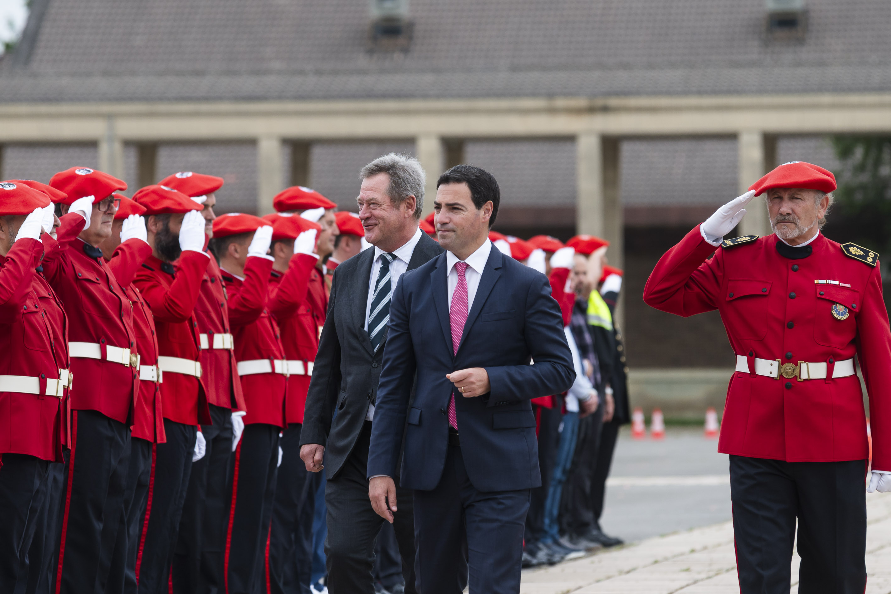
Urteroko oroimen eta sari banaketa ekitaldia egin du Ertzaintzak Arkautin, Eusko Jaurlaritzako agintarien parte hartzearekin. Duela bi urteko kronikatik aurtengora auziek edota gaiek berdintsuak izaten segitzen badute ere, nabarmena da begiratzeko moduak nola aldatu diren.

Kontsumitzaileen eskubideen defentsan, epaileek ebatzi dute bezeroak ez duela arduragabekeriaz jokatu eta bankuak 1.923 euro itzuli beharko dizkio biktimari.
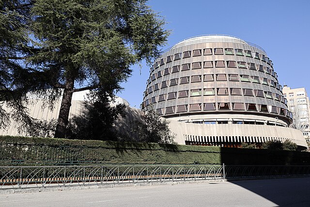
PPk ezarritako helegiteari erantzunez, legearen testua ia bere osotasunean konstituzionala dela dio auzitegiaren ebazpen proposamenak. Hala ere, legea pertsona gutxi batzuentzat dela dioen argudioan arrazoia eman dio eta herritar guztiei aplikatzea proposatu du.
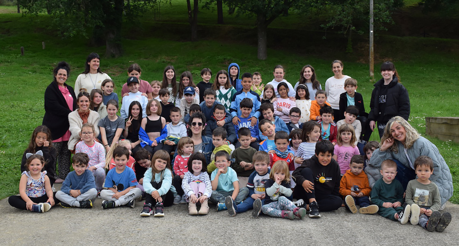
Herri txikiak bizirik dauden eremuak direla eta bizirik jarraitzeko herriari begiratuko dion eskola gakoa dela aldarrikatuko dute, aurten ere, Gipuzkoako Eskola Txikien Festan. Ekainaren 8an ospatuko dute, igandean, Ezkio-Itsason, landa guneko herri txikiak hezkuntzarako zein... [+]

Duela bi aste bezala, mila preso inguru trukatzea adostu dute Ukrainak eta Errusiak, eta batak besteari 6.000 soldaduren gorpuak ere itzuliko dizkio. Trukea egiteko, Moskuk hiru eguneko su-etena eskatu du fronteko hainbat eremutan, eta Kievek Putin eta Zelenski aurrez aurre... [+]

Asiako herrialde gehien-gehienak bertan izateak oso izaera eta giro berezia ematen diolako, eta hedabide-estaldura ere halakoa duelako, aparteko sona lortu du hogei urteren buruan IISS-International Institute for Strategic Studies britainiarrak Singapurren antolatzen duen Asia... [+]