


Society
Environment
Politics
Economy
Culture
Basque language
Feminism
Education
International
Opinion
thursday 29 may 2025
Automatically translated from Basque, translation may contain errors. More information here. 
The Gipuzkoa–Bizkaia border (II): Egoarbitza-Intxorta Historical Route through the Elgeta Mountains
We will start the excursion in the Plaza de los Mendizares in Elgeta (462m); we will complete the first meters of the excursion following the road that falls into the depths of Eibar, passing the port of Karabeta, until, when we arrive at a farm, the road that goes to the area of Larrabitzarra and inclining to the left until we enter the forest.
The first goal: The Self-Service
Due to its slightly modest height (735m), the Egoarbita is a singular peak that can be easily recognized from a distance because it is one of the few that has a small stone peak in the area where the pine reigns. The Egoarbitza is also on the left side of the road from Elgeta to Eibar, while the other most popular peaks, such as Azkonabieta, Topinburu, Galdaramuño or Krabelinatx, are on the right side of the road. These other peaks, which can be easily climbed from Soraluz, are covered by closed pine forests, drastically reducing the view -not to mention the antenna of the Azkonabieta peak...-. On the other hand, the egoarbita has a completely sober summit and we can enjoy a really beautiful view if we make the effort to climb it.
As we walk lightly through the clefts offered by the forest, we will have, from time to time, the rocky summit of Egoarbita in front of our eyes; before long we will reach the base of the last slope before reaching the summit. After resting in the cozy countryside, we will prepare ourselves to ascend to the summit of the Egoarbita. In front of it, it seems very difficult to climb on the pebble, but the bandage surrounds it from the right in search of the easiest path to climb. After passing through several passages of soft stone that must be carefully passed in case of rain, we will find the mailbox and the geodesic vertex.
As we walk lightly through the clefts offered by the forest, we will have, from time to time, the rocky summit of Egoarbita in front of our eyes; before long we will reach the base of the last slope before reaching the summit. After resting in the cozy countryside, we will prepare ourselves to ascend to the summit of the Egoarbita. In front of it, it seems very difficult to climb on the pebble, but the bandage surrounds it from the right in search of the easiest path to climb. After passing through several passages of soft stone that must be carefully passed in case of rain, we will find the mailbox and the geodesic vertex.
Self-service, 735m
The view over Eibar and Ermua, bathed by the stream of Ego that will die on the River Deba with the arrival of Malchaga, is wonderful from this summit. We have the mountains of Urko, Kalamua or Akondia, as well as Karakate, Atxolin, Izarraitz or Irukurutzeta, if you turn the observation towards Gipuzkoa, or all the summits of Durangaldea (Udalaitz, Anbotou, Alluitz, Zunillaitz, Mugarra, Gaintzorrotz, Urtemondo or Oiz), if you look towards Bizkaia. Carefully, we will dismantle on the same path that the last metro has climbed and return to the neck where there is a pleasant field.
After taking the last look at the egoarbite, we will continue the walk starting downhill; the next thing to do is to go down to the hole of the Aixola reservoir, the lowest point of the day -it should be taken into account that the Elgeta is located above 400 meters and the Aixola reservoir very close to Eibar, 300 meters high. The first part of this descent will be completed following a path almost entirely covered by the passage of time. The true mountaineer usually regrets that many of the traditional roads, many of the old paths that used to be used at one time to climb to the top of the mountains, are being lost because no one walks in them. The first part of the descent from the Egoarbita to the Aixola reservoir is one of them. Avoiding the bushes, we arrive at a wide mountain path of cement. Choosing the shortcuts that start down the pine forest in order to avoid this road, or the wide curves that the road makes, we will immediately arrive to the reservoir of Aixola (300 m) that supplies water to the Eibar Valley.
We cross the wall that supports the water of the reservoir and pass to the other side of the Aixola Valley; we have easily lost height below the Egoarbita and now we will have to recover the lost meters, climbing the slopes of Santa Marina Vieja and Erdella. On the other side of the reservoir we will find the red and white paint symbols corresponding to the long route GR-121 (Tour of Gipuzkoa), avoiding Erdella to the Elgeta-Elorrio road, first, and to the summit of Intxorta, then. It is possible to cut the route a little by following these painting symbols. However, we will climb the pine forest, drawing wide silks, selecting the best route at all times. After a bit of sweating, we reach the top of Santa Marina Vieja. The view offered by this summit is unique. Durango, on the other hand, Zaldibar, Ermua, Eibar and eleven neighborhoods and farms scattered on the slopes of the surrounding mountains. The mountains of Durangaldea, from Udalaitz and Anbotou to Aramós, Oiz, Urko, Karakate... Oh, that's wonderful. The next climb to Erdella will be closer than ever.
Without losing much height, we will continue our walk directly towards the hill of Erdella; before climbing the last slope we will meet again with the red and white paint symbols of the long route GR-121 that come directly from Aixola. These painting symbols leave the peak of Erdella (682 m) on the left and this is an opportunity to smooth the route if you are tired. We, strong and seasonal, will make an effort to climb to the tip covered with trees. Erdella unfortunately does not offer a wide view and we will start the descent route as soon as we recover a little breath.
The historic summit of Intxorta is the only one we need to complete this beautiful circular route, but before crossing the Elgeta-Elorrio road and going up the slopes of Intxorta we will pass through the hermitage of San Urbano (Santruan). In the past, it is said that on May 25 (Saint’s Day) Mass and Pilgrimage were celebrated around this hermitage. This custom was lost a long time ago. It is said that in ancient times they brought children who were very mourning, to this hermitage, believing that they would be formalized with the candle lit to the saint.
The smell of walnut warfare
The frequency of heartbeats will accelerate unconsciously with the search for the summit of Intxorta; as we approach the summit, we will perceive that we are taking each step in an exciting mountainous area of the Basque Country. In fact, it was around the summits of Intxorta that the long lines of defense were formed in the spring of 1937 to face the Francoist troops. The so-called Biscay offensive began in the last days of March 1937, and after heavy fighting, on April 24, the Francoists began their offensive from the east and west to take the Intxorta line. Seeing that it was not possible to maintain the front any longer, the commanders Caterpillar and Plazaola decided to retire from a narrow passage towards Ermua.
With the old issues in mind, we will reach the top of Intxorta before long. It’s only a short walk to Elgeta again. In addition to the main peak (743 m), Intxorta also has two other hills, the small Intxorta (715 m) and the Peñón del Castillo (718 m). To return to Elgaeta we will undo the last meters of the slope of Intxorta and return to a crossroads that we passed during the ascent. We will do it quickly by following the yellow white symbols of Margo, whistling the memorable melodies of Joseba Tapia’s beloved Farewell Nut, the Way to the Elgas. Goodbye, I love the Walnut.
With the old issues in mind, we will reach the top of Intxorta before long. It’s only a short walk to Elgeta again. In addition to the main peak (743 m), Intxorta also has two other hills, the small Intxorta (715 m) and the Peñón del Castillo (718 m). To return to Elgaeta we will undo the last meters of the slope of Intxorta and return to a crossroads that we passed during the ascent. We will do it quickly by following the yellow white symbols of Margo, whistling the memorable melodies of Joseba Tapia’s beloved Farewell Nut, the Way to the Elgas. Goodbye, I love the Walnut.
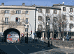
Elgeta, Mendizaleen plaza
Euskal mendizaletasunarentzat toki esanguratsurik bada, Elgetako plaza da, zalantzarik gabe, horietako bat.
Elorrio eta Bergara batzen dituen errepidea arku baten azpitik igarotzen da Elgetako sarreran, garai batean arbitrio etxea izandakoaren petik. Udaletxearen eraikina da Elgetako plazako buru eta plaza honetatik osteratxo bat egitea, historian atzera, eta euskal mendizaletasunaren historia sentimentalean barrena bidaiatzea da. Udaletxearen karrerapearen gainean, zenbait plaka dago honako hitz hauek irakur daitezkeelarik: Federación Vasco Navarra de Montañismo, Urrezko Ezteiak, 1924-1974; Federación Vasco Navarra de Montañismo, 1924-1999. Izan ere Elgetako plazaren gaur egungo izena bera «Mendizaleen plaza» da izan (1926an Plaza del Alpinismo izenez bataiatu eta 1978an moldaturiko izena). Udaletxearen parean dagoen Oskarbi Elkartearen aurrealdean, berriz, beste plaka batek toki horretan, 1924ko maiatzaren 18an, Euskal Mendizale Federakundea sortu zela gogoratzen du (Federación Vasco Navarra de Alpinismo, hastapenean).
Elgetako plaza, beraz, mendizale federakundearen abiapuntua da; ordura arteko elkarte txikiak elkartu, helburuak bateratu, eta ekimenak elkarrekin sustatzeko aukera eman zien federazioak. Helburu hori ongi zehaztuta dago ezarri zuten arautegiaren lehen artikuluan:
- Baskongadetako hiru probintzietako eta Nafarroako mendi eta txangozaletasun-elkarte guztiak biltzen dituen erakunde komun eta nagusia da, mendiarekin eta txangozaletasunarekin zerikusia duten gai interesgarri guztiak sortu, gestionatu eta antolatzeaz arduratzen dena
Intxortako atea, oroimena gerrari ez
Datorren hilabetean ekitaldi sorta egingo dute Elgetan gerrako gertaerak gogoratzeko. Egun nagusia martxoaren 25a, igandearekin, ospatuko dute.
Juan Jose Arangurenek Intxortako Atea eskultura egin du eta Euzko Gudarostearen defentsa lerro nagusia zegoen gunean jarriko dute, Asentzioko ermitatik hurbil, Partaitxikin. Ezkerreko argazkian, Partaitxikik orain 70 urte zuen itxura. «Erasoengandik babesten gaituen horma irudikatu nahi izan du» egileak, «segurtasuna eskaintzen duena, ate bat eraikitzeko horma bat apurtzetik jaiotzen dena».
36ko Gerran Elgetako frontean jazotakoen inguruko erakusketa ere egingo dute Espaloia Kafe Antzokian. Gainera Intxortako frontea defendatu zuten gudari eta miliziarrei omenaldia egingo diete herriko plazan; Intxorta erasotu zutenak ere gonbidatuko dituzte. Horren ostean bazkaritara bilduko dira pilotalekuan. 2.000 lagun bildu gura dituzte.
Martxoaren 22an, ekitaldien atarian, Jesus Gutierrezen La guerra civil en Eibar y Elgeta liburua aurkeztuko dute udaletxean.
Eskuinean Intxortako Atea eskulturaren maketa. Orijinala Altzairuzko pieza da eta zazpi metro pasa izango ditu luzean.


Most read
Using Matomo
#1
#3
#4
Paul Beitia Ariznabarreta
#5
Mara Altuna Díaz

Newest
2025-05-29
Eneko Imaz Galparsoro
Bergarako paper hondakinen pirolisi plantari Jaurlaritzak emandako ingurumen baimena baliogabetu du EAEko Auzitegi Nagusiak
Jaurlaritzak Valogreene enpresari ingurumen baimena eman izanari helegitea aurkeztu zioten Bergarako Udalak, Ekologistak Martxan taldeak eta Bergarako bi bizilagunek 2022ko apirilean. Udalak azpimarratu du auzitegiak arrazoia eman diola, ebatzi baitu Jaurlaritzak hartu... [+]

2025-05-29
ARGIA
Trumpen muga-zerga orokorrak atzera bota ditu AEBetako epaimahai batek
Epaiak dio AEBetako presidentea bere eskumenetik harago joan dela muga-zergak ezartzerakoan, eta hamar eguneko epea ematen dio horiek kentzeko.
2025-05-29
Gedar
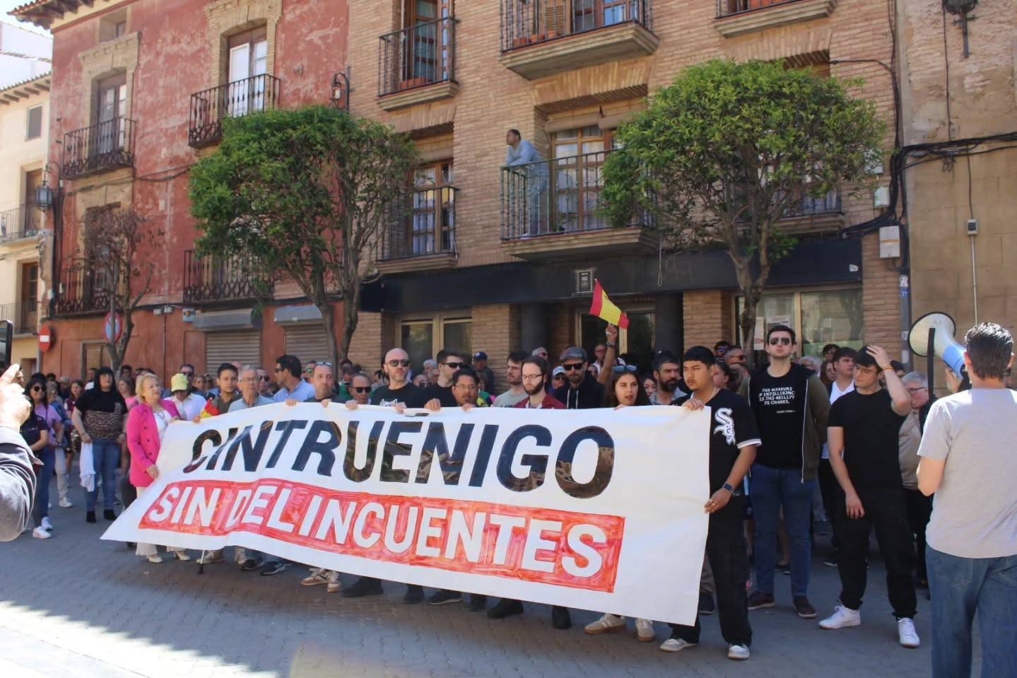
In Cintruenigo, Frente Obrero and Vox mobilize from arm to arm
The “Cintruenigo without delinquency” has been proclaimed, as usual, criminalizing migrant people.
2025-05-29
Hala Bedi
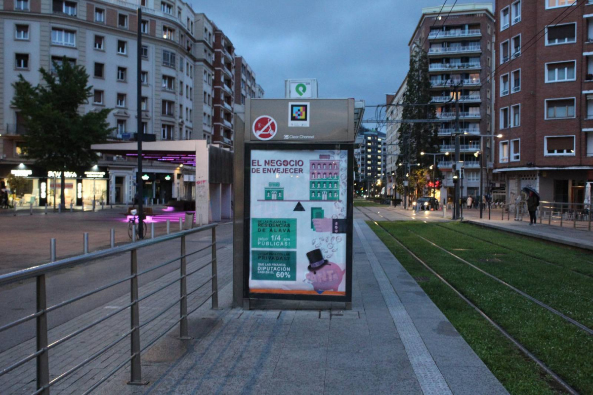
The business of aging is revealed in Vitoria
Advertisements denouncing the business of nursing homes have been placed in several marquesinas in Vitoria-Gasteiz. These announcements are signed by the "Foral Organization for Social Malaise".
2025-05-29
Mikel Garcia Idiakez
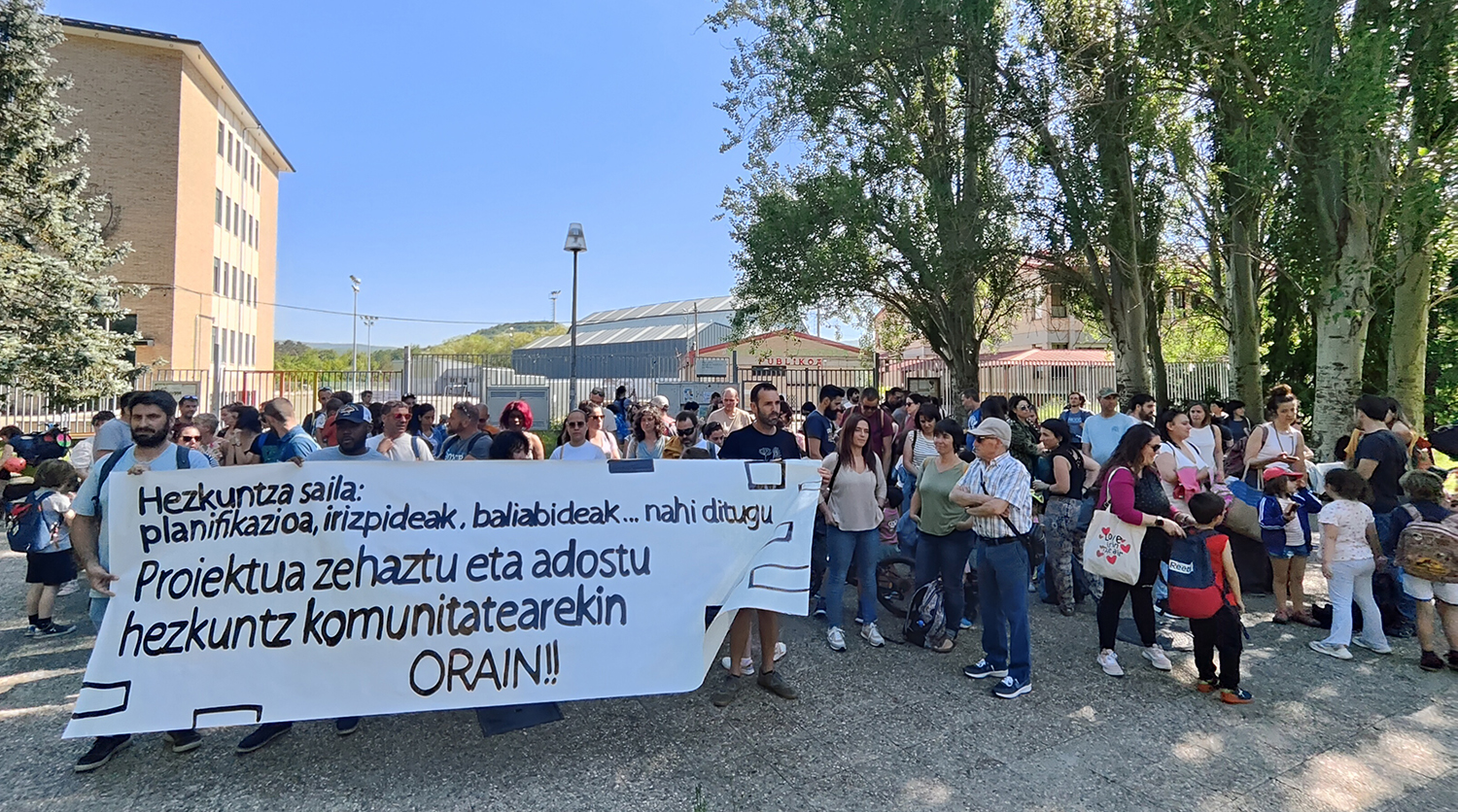
Parents ask the Government to clarify and agree on the new project of two schools to be merged
The schools of Adurtza and San Ignacio in Vitoria-Gasteiz will start the next school year fused, but parents have denounced the lack of project and planning of the new school, wanting to know when and how to make their contributions. “We want to participate, give opinions and... [+]
2025-05-28
Maria Ortega Zubiate
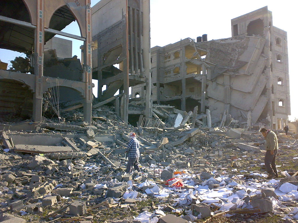
Hamas leader killed by Israel, Netanyahu said
Hamas leader Mohamed Sinwar has been found dead during an Israeli military bombing of Gaza. Hamas has not yet confirmed Sinwar's death.
2025-05-28
Joan Mari Beloki
The Istanbul II
The four belligerent European presidents (Emmanuel Macron, Keir Starmer, Friedrich Merz and Donald Tusk) demanded a 30-day ceasefire from Vladimir Putin on May 10. Response from the Russian President: “On May 15, let’s start negotiating peace in Istanbul.”
The two... [+]
2025-05-28
Maria Ortega Zubiate
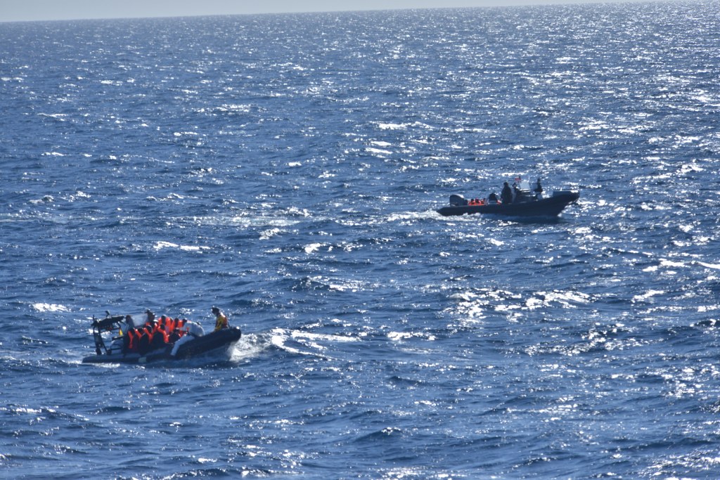
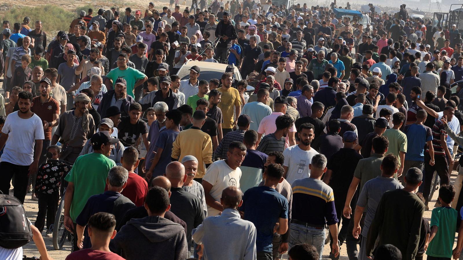
At least five migrants die after the sinking of their ship in the Canary Islands
The incident took place on the island of El Hierro in the Canary Islands, where the boat turned around when they were five meters from the shore. One child is seriously injured and another is missing. About 180 people were on board.
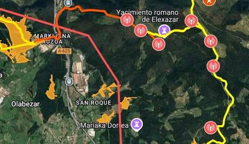
Mountains of Ayala Bizirik denounces that the Provincial Council of Álava is "invading competences" to impose wind power plants
The Popular Platform has indicated that the 'Mendi' wind power plant also takes land in Orozko (Bizkaia) and that the Provincial Council of Álava has ordered the start of the pre-approval procedure for the special plan.
2025-05-28
Ekologistak Martxan
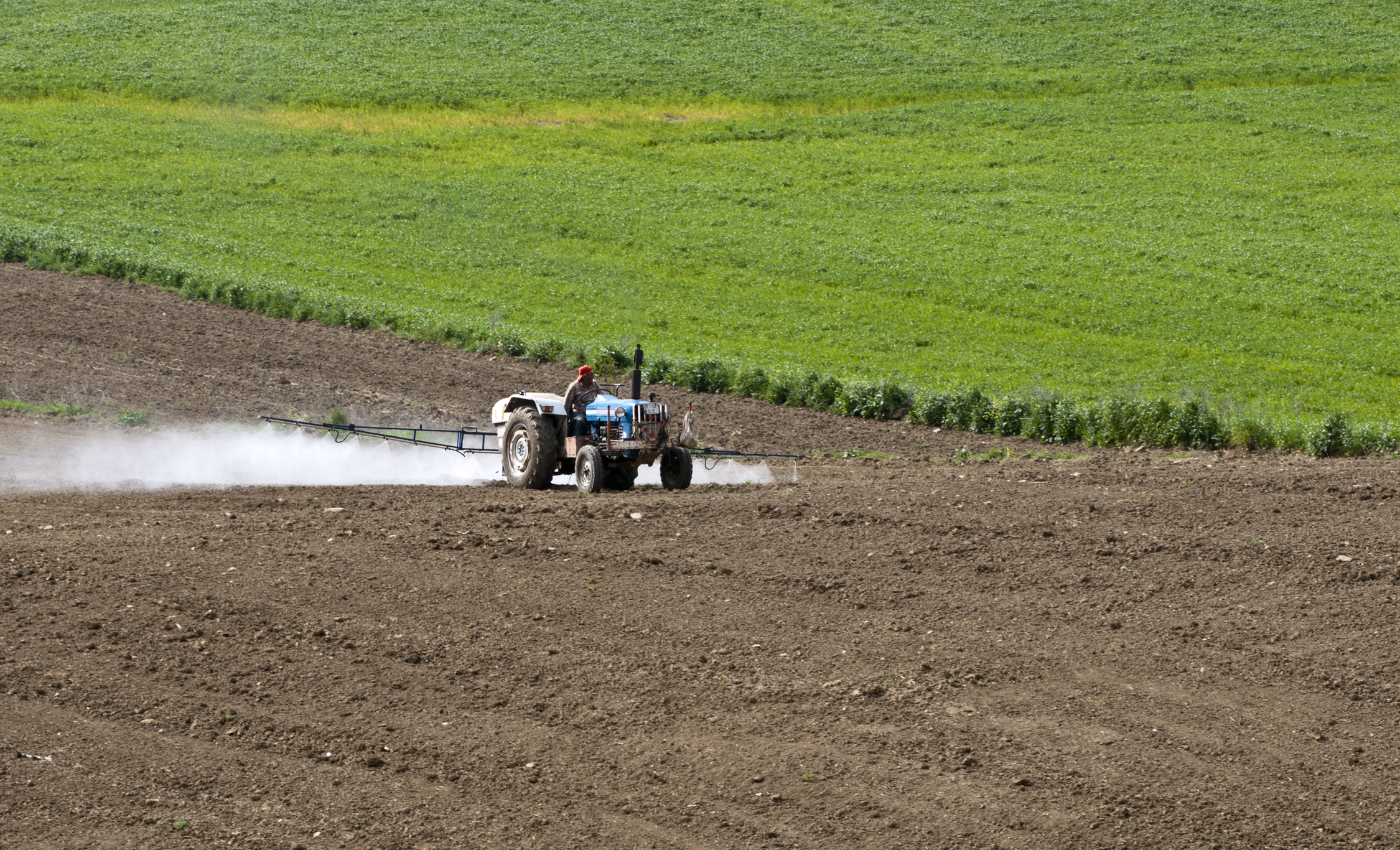
Daily food is contaminated with 130 pesticides, 23% more than in the previous year
2025-05-28
Maria Ortega Zubiate
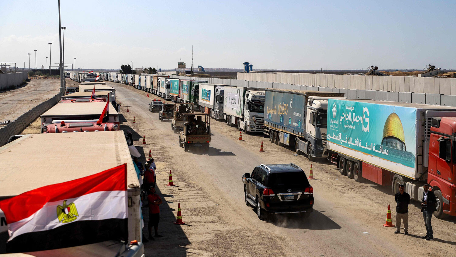
Israel kills three Palestinians while delivering humanitarian aid
Israel has entrusted the distribution of humanitarian aid to a U.S. company, and the UN has denounced the images of the distribution of aid as “very serious.” Israel has defended the system of separation. It is reported that no humanitarian aid will be provided on Wednesday.

2025-05-28
ARGIA
French Assembly Approves Law Authorizing Aid for Death
By deliberately avoiding words such as euthanasia or assisted suicide, the French National Assembly has passed a law authorizing “active help to kill”. If approved by the Senate, the law would enter into force in 2027 in the fastest case.
2025-05-28
Urko Apaolaza Avila
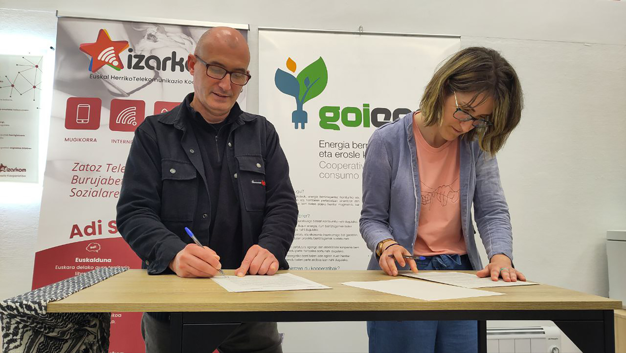
Goiener and Izarkom launch a collaboration to create a "resilient" energy and telecommunications system
The two cooperatives have announced that they will take “stronger steps” in their collaboration to create a “resilient” energy and telecommunications system. Citizens are called to turn off the system, turn on the alternatives so they can join the manifesto.
Eguneraketa berriak daude