
OmnesViae, the Roman Google Maps
- The online project OmnesViae (in Latin, all roads) is the most complete interactive map of the Roman roads.
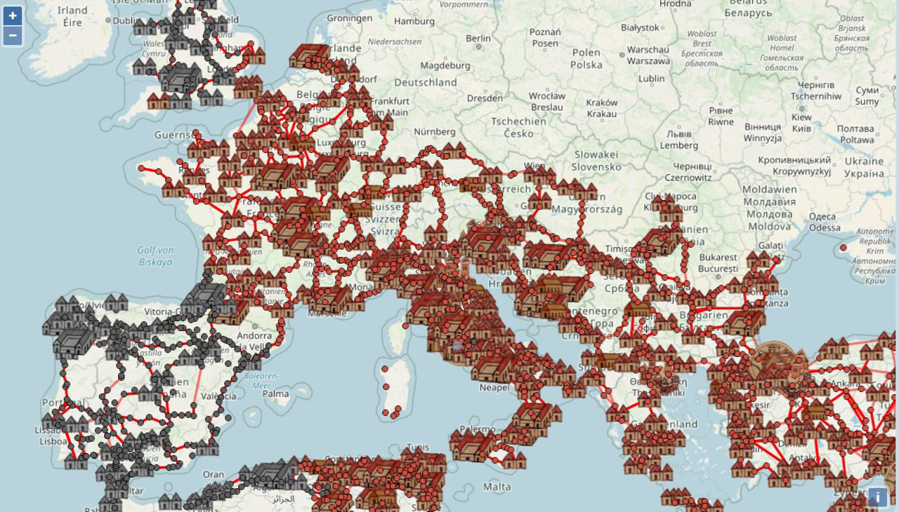
Argazkia: Omnesviae
d. C. It is based on the collection of Tabula Peutingeriana itineraries of the 4th century, on a map that included, in addition to the roads, the existing accommodations along the way.
Like Google Maps, the app calculates the most suitable route to travel from one place to another in the Empire thanks to 2,000 landmarks. To do this, you only have to fill the Ab (from where) and Ad (from where) cells and click the Ostendere button (show). And by clicking on Fere Dies, it will also tell us how many days we need to make the way.